


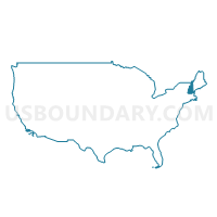
Southwestern New Hampshire--Cheshire & Sullivan Counties PUMA, New Hampshire
About
Outline

Summary
| Unique Area Identifier | 193362 |
| Name | Southwestern New Hampshire--Cheshire & Sullivan Counties PUMA |
| State | New Hampshire |
| Area (square miles) | 1,281.09 |
| Land Area (square miles) | 1,243.97 |
| Water Area (square miles) | 37.12 |
| % of Land Area | 97.10 |
| % of Water Area | 2.90 |
| Latitude of the Internal Point | 43.10575110 |
| Longtitude of the Internal Point | -72.23982870 |
Maps

Graphs
Select a template below for downloading or customizing gragh for Southwestern New Hampshire--Cheshire & Sullivan Counties PUMA, New Hampshire


Neighbors
Neighoring Public Use Microdata Area (by Name) Neighboring Public Use Microdata Area on the Map
- Central New Hampshire--Merrimack County (Central)--Concord City PUMA, NH
- Franklin & Hampshire (North) Counties PUMA, MA
- Hillsborough County (Western) PUMA, NH
- Lakes Region--Belknap, Carroll & Merrimack (Northern) Counties PUMA, NH
- Northern New Hampshire--Grafton & Coos Counties PUMA, NH
- Southeast Vermont--Windsor, Windham & Orange Counties PUMA, VT
- Worcester & Middlesex Counties (Outside Leominster, Fitchburg & Gardner Cities) PUMA, MA
Top 10 Neighboring County (by Population) Neighboring County on the Map
- Worcester County, MA (798,552)
- Hillsborough County, NH (400,721)
- Merrimack County, NH (146,445)
- Grafton County, NH (89,118)
- Cheshire County, NH (77,117)
- Franklin County, MA (71,372)
- Windsor County, VT (56,670)
- Windham County, VT (44,513)
- Sullivan County, NH (43,742)
Top 10 Neighboring County Subdivision (by Population) Neighboring County Subdivision on the Map
- Keene city, Cheshire County, NH (23,409)
- Claremont city, Sullivan County, NH (13,355)
- Lebanon city, Grafton County, NH (13,151)
- Brattleboro town, Windham County, VT (12,046)
- Winchendon town, Worcester County, MA (10,300)
- Springfield town, Windsor County, VT (9,373)
- Swanzey town, Cheshire County, NH (7,230)
- Newport town, Sullivan County, NH (6,507)
- Peterborough town, Hillsborough County, NH (6,284)
- Ashburnham town, Worcester County, MA (6,081)
Top 10 Neighboring Place (by Population) Neighboring Place on the Map
- Keene city, NH (23,409)
- Claremont city, NH (13,355)
- Lebanon city, NH (13,151)
- Brattleboro CDP, VT (7,414)
- Newport CDP, NH (4,769)
- Bellows Falls village, VT (3,148)
- Peterborough CDP, NH (3,103)
- Jaffrey CDP, NH (2,757)
- Windsor CDP, VT (2,066)
- Winchester CDP, NH (1,733)
Top 10 Neighboring Elementary School District (by Population) Neighboring Elementary School District on the Map
- Brattleboro School District, VT (12,046)
- Rockingham School District, VT (5,282)
- Winchester School District, NH (4,341)
- Chesterfield School District, NH (3,604)
- Hartland School District, VT (3,393)
- Westminster School District, VT (3,178)
- Grantham School District, NH (2,985)
- Putney School District, VT (2,702)
- Plainfield School District, NH (2,364)
- Vernon School District, VT (2,206)
Top 10 Neighboring Secondary School District (by Population) Neighboring Secondary School District on the Map
- Brattleboro Union High School District 6, VT (20,939)
- Bellows Falls Union High School District 27, VT (9,581)
Top 10 Neighboring Unified School District (by Population) Neighboring Unified School District on the Map
- Keene School District, NH (23,409)
- Contoocook Valley School District, NH (18,677)
- Kearsarge Regional School District, NH (15,458)
- Monadnock Regional School District, NH (14,645)
- Ashburnham-Westminster School District, MA (13,358)
- Claremont School District, NH (13,355)
- Lebanon School District, NH (13,151)
- Athol-Royalston School District, MA (12,842)
- Fall Mountain Regional School District, NH (12,364)
- Jaffrey-Rindge Cooperative School District, NH (11,471)
Top 10 Neighboring State Legislative District Lower Chamber (by Population) Neighboring State Legislative District Lower Chamber on the Map
- Second Franklin District, MA (40,959)
- Second Worcester District, MA (40,941)
- Second Berkshire District, MA (40,125)
- State House District 3, Cheshire County, NH (23,409)
- State House District 4, Sullivan County, NH (16,180)
- State House District 3, Hillsborough County, NH (13,840)
- State House District 11, Grafton County, NH (13,151)
- State House District 7, Cheshire County, NH (13,068)
- State House District 6, Cheshire County, NH (12,399)
- State House District 4, Cheshire County, NH (11,991)
Top 10 Neighboring State Legislative District Upper Chamber (by Population) Neighboring State Legislative District Upper Chamber on the Map
- Worcester, Hampden, Hampshire & Franklin District, MA (163,941)
- Hampshire & Franklin District, MA (156,938)
- Windsor State Senate District, VT (56,670)
- State Senate District 11, NH (56,670)
- State Senate District 7, NH (54,987)
- State Senate District 8, NH (54,222)
- State Senate District 5, NH (53,856)
- State Senate District 10, NH (52,718)
- Windham State Senate District, VT (42,637)
Top 10 Neighboring 111th Congressional District (by Population) Neighboring 111th Congressional District on the Map
- Congressional District 2, NH (658,486)
- Congressional District 1, MA (644,956)
- Congressional District (at Large), VT (625,741)
Top 10 Neighboring Census Tract (by Population) Neighboring Census Tract on the Map
- Census Tract 7011, Worcester County, MA (8,340)
- Census Tract 9709, Cheshire County, NH (7,230)
- Census Tract 225, Hillsborough County, NH (6,817)
- Census Tract 9754, Sullivan County, NH (6,507)
- Census Tract 230, Hillsborough County, NH (6,284)
- Census Tract 255, Hillsborough County, NH (6,235)
- Census Tract 7001, Worcester County, MA (6,081)
- Census Tract 9706, Cheshire County, NH (6,014)
- Census Tract 9685, Windham County, VT (5,807)
- Census Tract 9710, Cheshire County, NH (5,602)
Top 10 Neighboring 5-Digit ZIP Code Tabulation Area (by Population) Neighboring 5-Digit ZIP Code Tabulation Area on the Map
- 03431, NH (25,280)
- 05301, VT (16,820)
- 03743, NH (14,103)
- 01475, MA (10,270)
- 05156, VT (9,226)
- 03766, NH (8,958)
- 03244, NH (8,092)
- 01364, MA (7,969)
- 03773, NH (7,841)
- 03458, NH (6,643)